🔎 OSINT Case Study: Geolocating Where @ridwanhr Promotes A Motorcycle
A motorcycle promoted by @ridwanhr. Let's find out where it was!
Written on November 23, 2024 · 18 min read
Every photo tells a story—and sometimes, it holds a mystery. Today, we dive into a photo posted by the well-known Indonesian automotive influencer, @ridwanhr, as part of a motorcycle promotion. Our task? To pinpoint the exact location where the photo was taken using open-source intelligence (OSINT) techniques. By carefully analyzing visual clues, cross-referencing data, and applying critical thinking, we’ll uncover the hidden story behind the image.
Task Briefing
| Key | Value |
|---|---|
| Brief | A famous Indonesian automotive influencer, @ridwanhr, promotes a motorcycle model. We are going to geolocate where the photo was taken. |
| Objectives | 1. Identify where the photo was taken. |
| 2. What's the coordinate of the location? | |
| 3. Tell a story about the location. | |
| Original URL | https://www.instagram.com/p/DCjIKFYzqFn |
| Difficulty Level | For Beginner: easy |
| For Expert: easy | |
| Data Source | 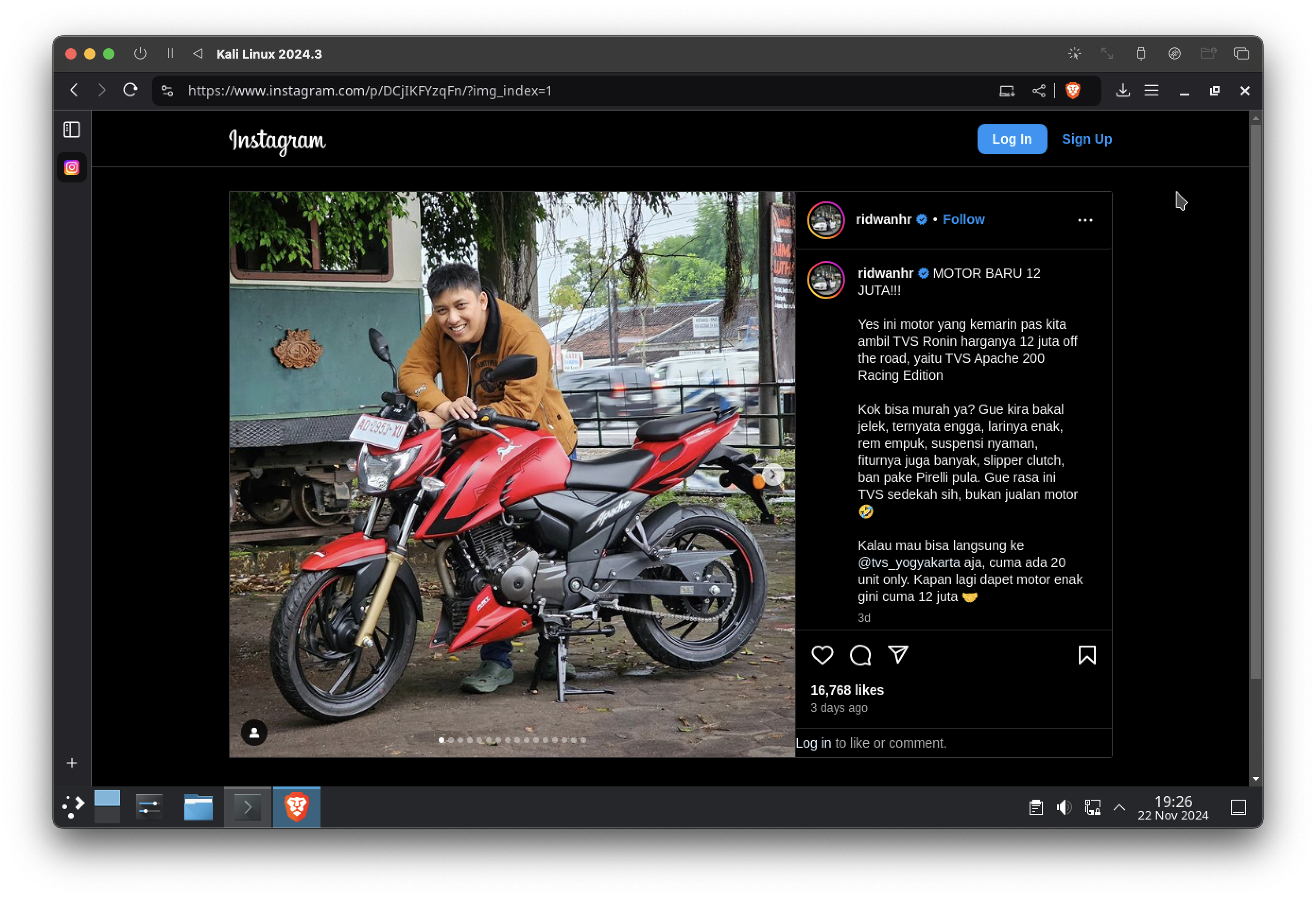 |
Let’s Start the Investigation
A prominent Indonesian automotive influencer, @ridwanhr, posted a photo promoting a new motorcycle model. While the motorcycle is undoubtedly captivating, our focus today is not the machine but the mystery of where the photo was taken.
The image was publicly posted on November 19, 2024, on his Instagram account, making it a perfect case for ethical OSINT exploration. Here’s the image we’ll be working with:
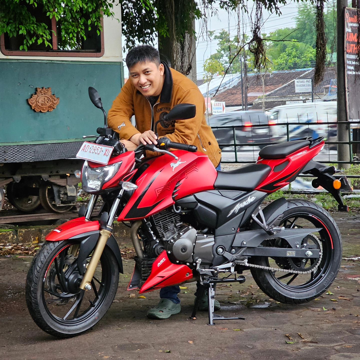
Let’s start dissecting this case!
EXIF Data: The Missing Puzzle Piece
In any OSINT investigation, examining EXIF data is often the first step. EXIF (Exchangeable Image File Format) metadata can provide valuable information such as GPS coordinates, timestamps, and camera settings. However, in this case, the EXIF data reveals nothing useful. This is expected, as most social media platforms strip metadata to protect user privacy.
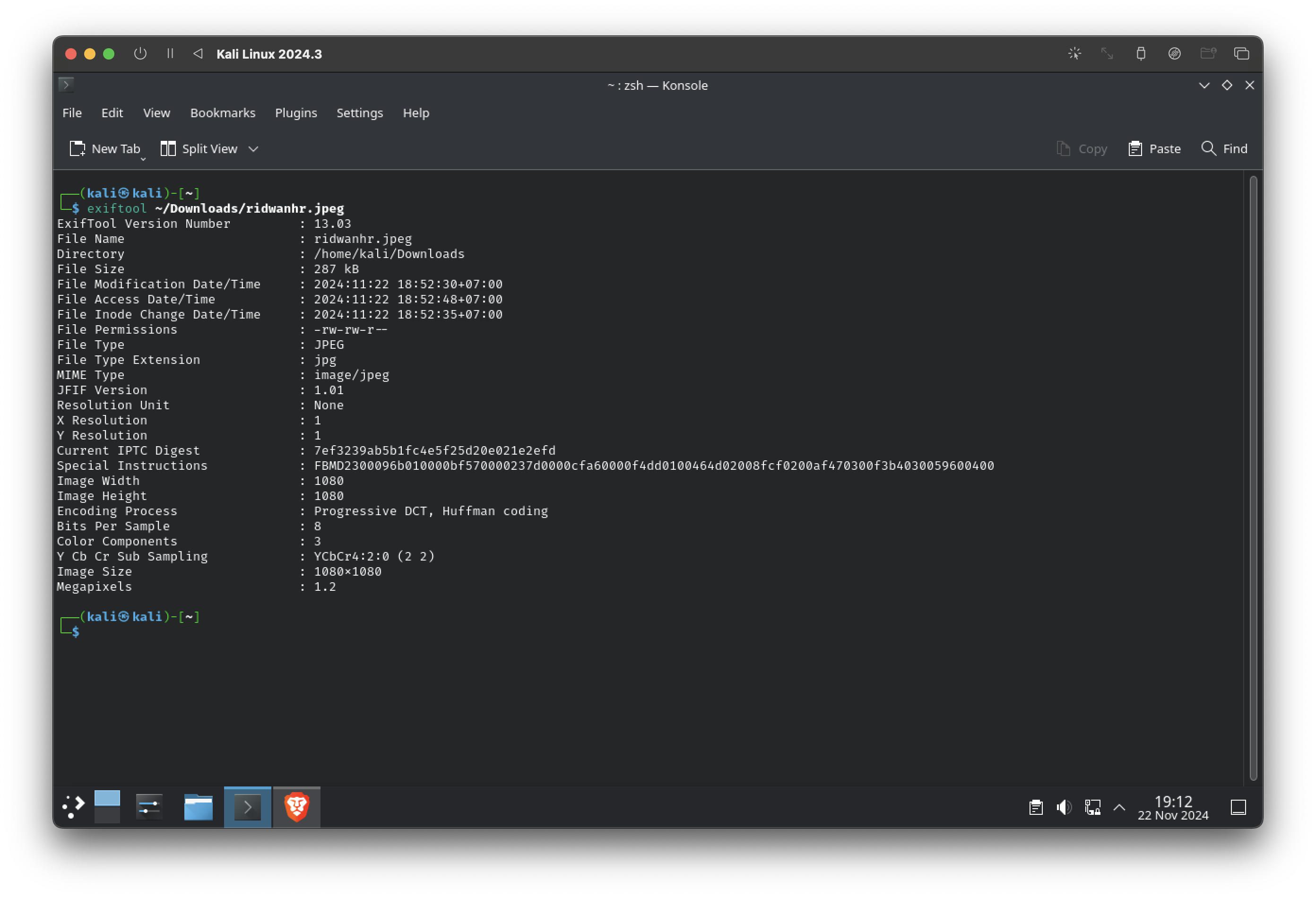
Key Takeaway: Privacy protections on social media prevent us from relying on EXIF data alone. This forces us to look deeper and shift our focus to visual clues in the photo itself.
Analyzing the Photo: Clues Hidden in Plain Sight
The next step is to carefully analyze the photo. Upon close inspection, several intriguing elements stand out:
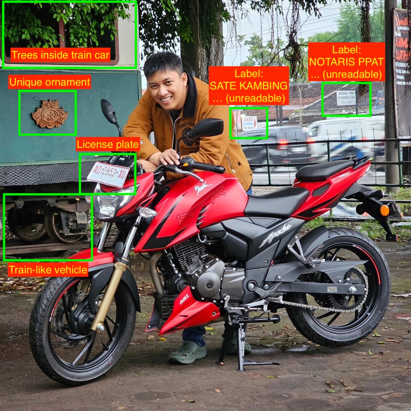
Key Observations:
- License Plate: A clear view of the vehicle’s license plate provides a vital regional clue.
- Train-like Vehicle: Behind @ridwanhr, there’s a train-like vehicle with trees growing inside. This detail is both peculiar and fascinating.
- Shadows and Lighting: The subdued lighting and absence of direct sunlight on the foreground suggest the area is heavily shaded, possibly by a large structure or dense foliage.
These observations serve as breadcrumbs for the next steps in our investigation.
License Plate: Unlocking Regional Clues
Indonesia’s vehicle registration plates use a structured system that encodes the region where a vehicle is registered. Here’s a quick breakdown:
- Format:
AA BBBB CCCAArepresents the area code.BBBBis the serial number.CCCis the sub-area code.
Decoding the License Plate
In the photo, the license plate reads AD 2953 XU. Referring to Wikipedia: Vehicle registration plates of Indonesia, the AD code corresponds to Central Java, specifically:
- Surakarta
- Sukoharjo
- Boyolali
- Sragen
- Karanganyar
- Wonogiri
- Klaten
Color Analysis
The license plate’s red-on-white color indicates a temporary registration. This is typically assigned to new vehicles that have yet to receive official documentation.
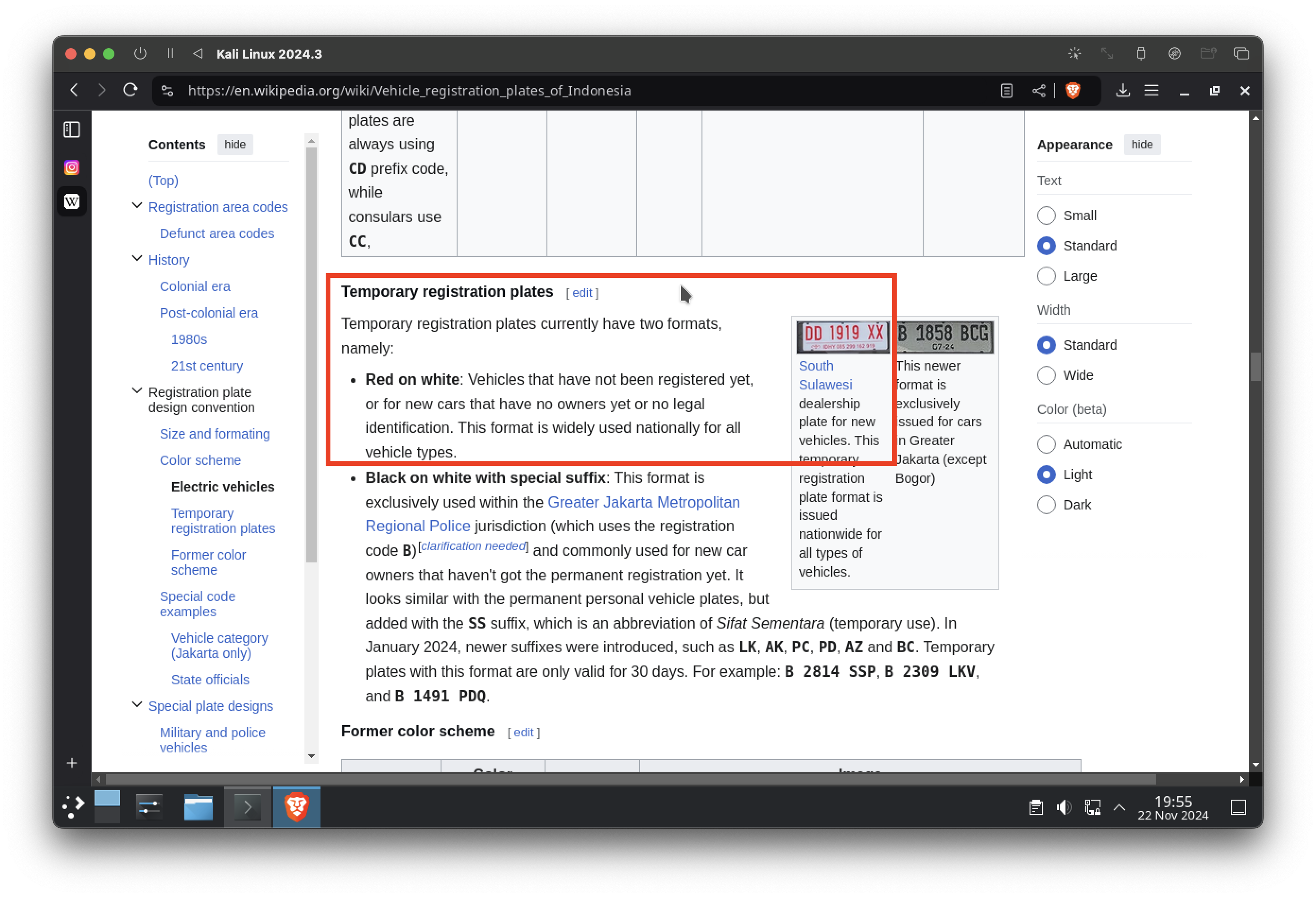
Critical Insight: The combination of the AD code and the temporary plate suggests this vehicle is newly registered in the Central Java region. Our location is narrowing.
The Train-like Vehicle: A Puzzling Detail

Among the most intriguing elements in the photo is the train-like vehicle. Let’s break down its peculiarities:
- Trees Inside the Carriage: This immediately suggests it’s not an operational train but a stationary display, possibly part of a museum or historical exhibit.
- Old Yet Maintained: The carriage looks historic, but it isn’t abandoned or derelict. This hints at a location with cultural or historical significance.
- Shaded Environment: The absence of direct sunlight on the carriage or @ridwanhr suggests the area is under a large canopy, likely from trees or a nearby structure.
These clues lead us to consider historical sites or museums related to railways or transportation in the region.
Train History in Indonesia: Contextual Clues
If we are going to talk about train in Indonesia, it has a very long history. There is a dedicated page that you can you can read: Wikipedia: Rail transport in Indonesia. It will be unwise to retell the history here, but these are what we can get from the page:
- The first railway line in Indonesia opened in 1867.
- The first railways in Indonesia were built on the island of Java, using 1,435 mm (4 ft 8+1⁄2 in) gauge.
- Indonesia has The Ambarawa Railway Museum, located in Ambarawa, Central Java (but it does not match our license plate code).
- Back in the days, the trains were used to transport sugarcane to sugar mill/refinery called Pabrik Gula (PG).
- There is a sugar refinery that matches the location with the license plate code called PG Gondang Winangoen, located in Klaten.
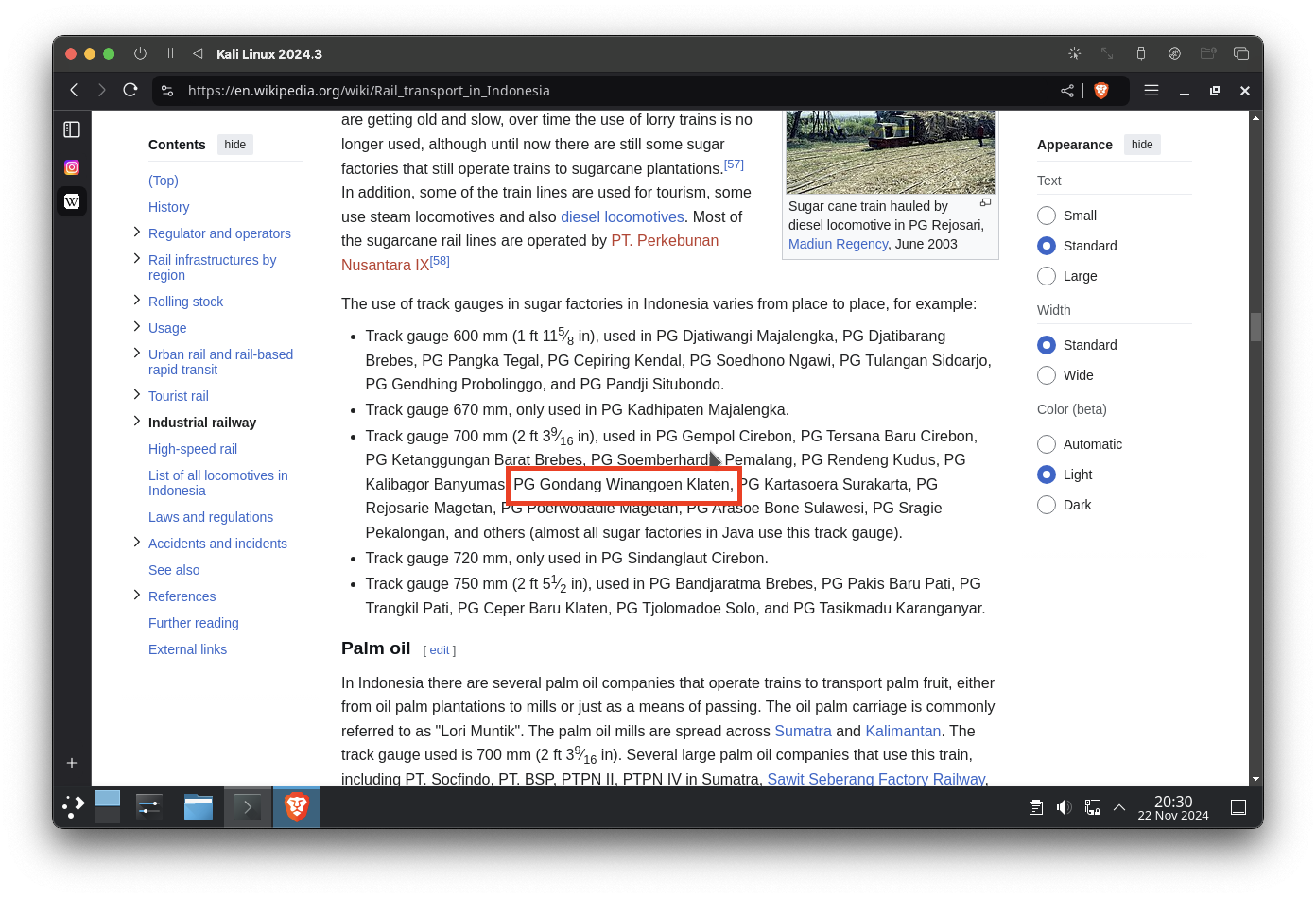
So far, PG Gondang Winangoen is the closest lead we have. Why?
- The refinery is located within the AD license plate region (Klaten, Central Java).
- Historically, sugar refineries like PG Gondang often transported sugarcane via rail, making trains a key part of their heritage.
Confirming the Location: The Final Clue
Our search for PG Gondang Winangoen on Google Maps brings us tantalizingly close to solving the mystery. The map clearly shows a train-like vehicle behind a fence—an unmistakable match to the one visible in @ridwanhr’s photo.
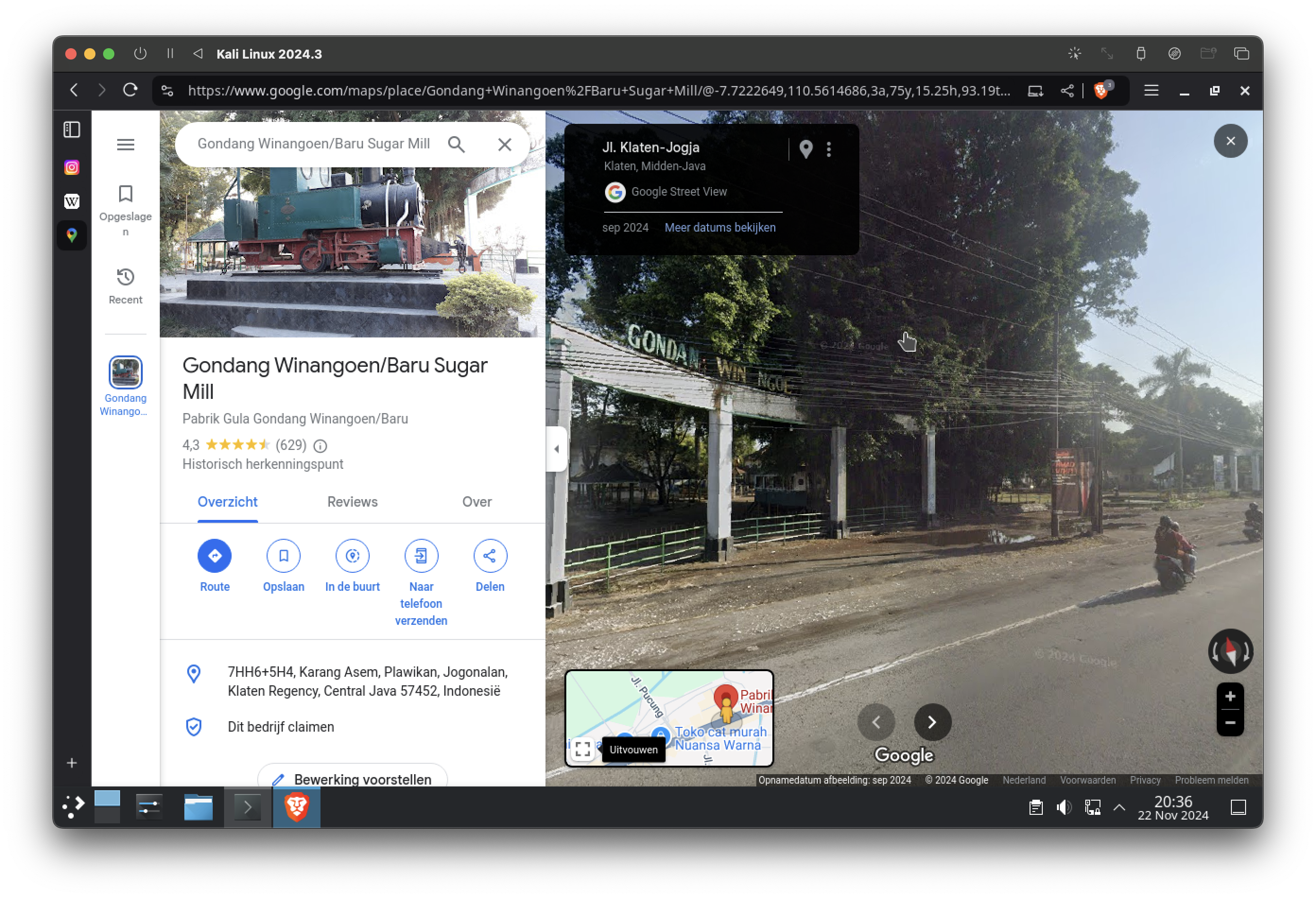
Zooming in provides further confirmation. The train carriage, surrounding trees, and nearby structures align perfectly with the photo. The resemblance is undeniable.
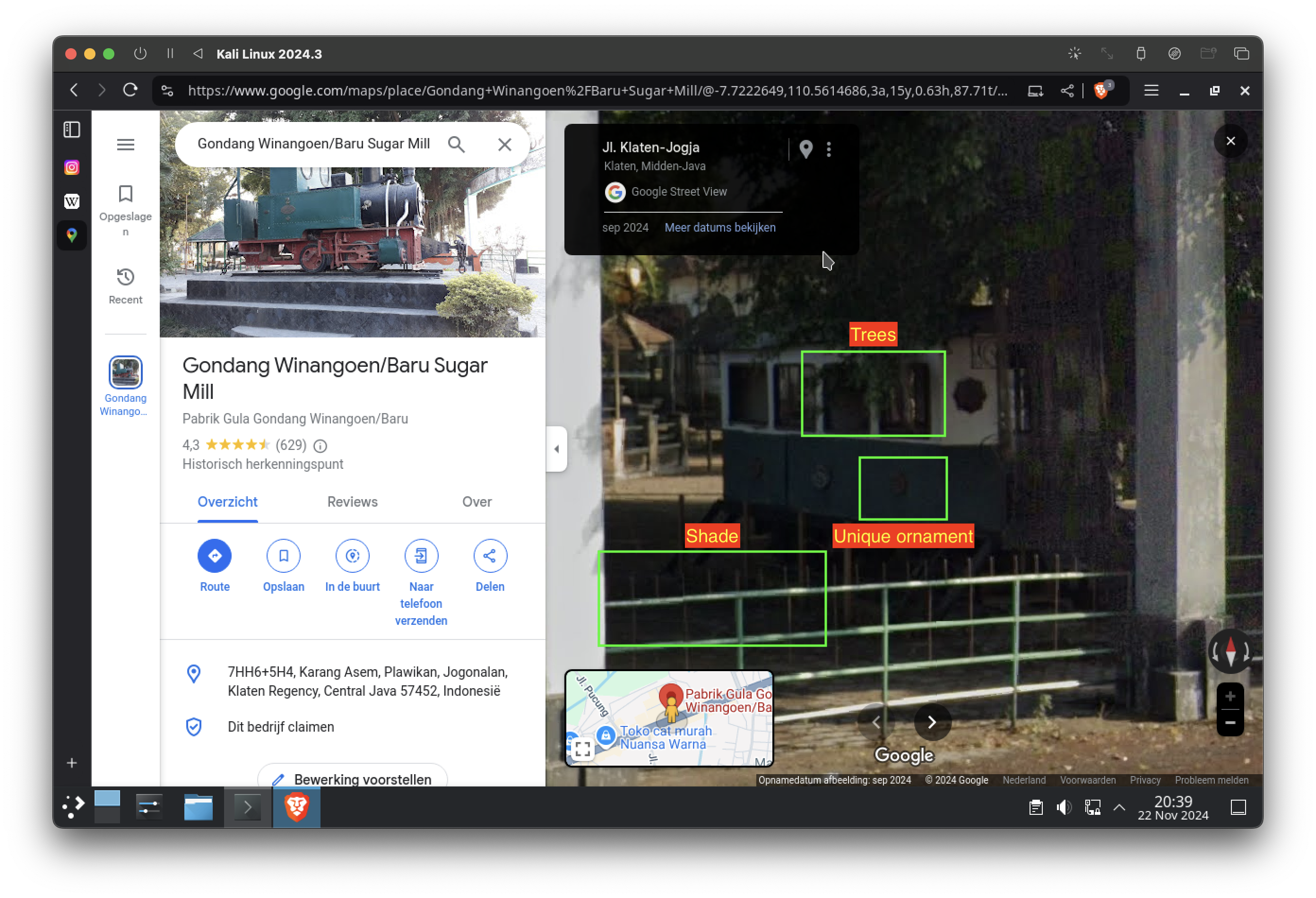
But is that enough? In the spirit of thorough investigation, let’s dig deeper and analyze two additional clues from the surroundings:
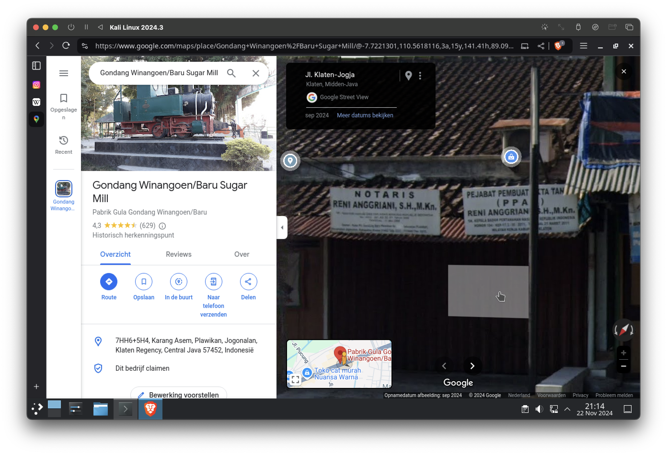
- The “Notaris/PPAT” Label
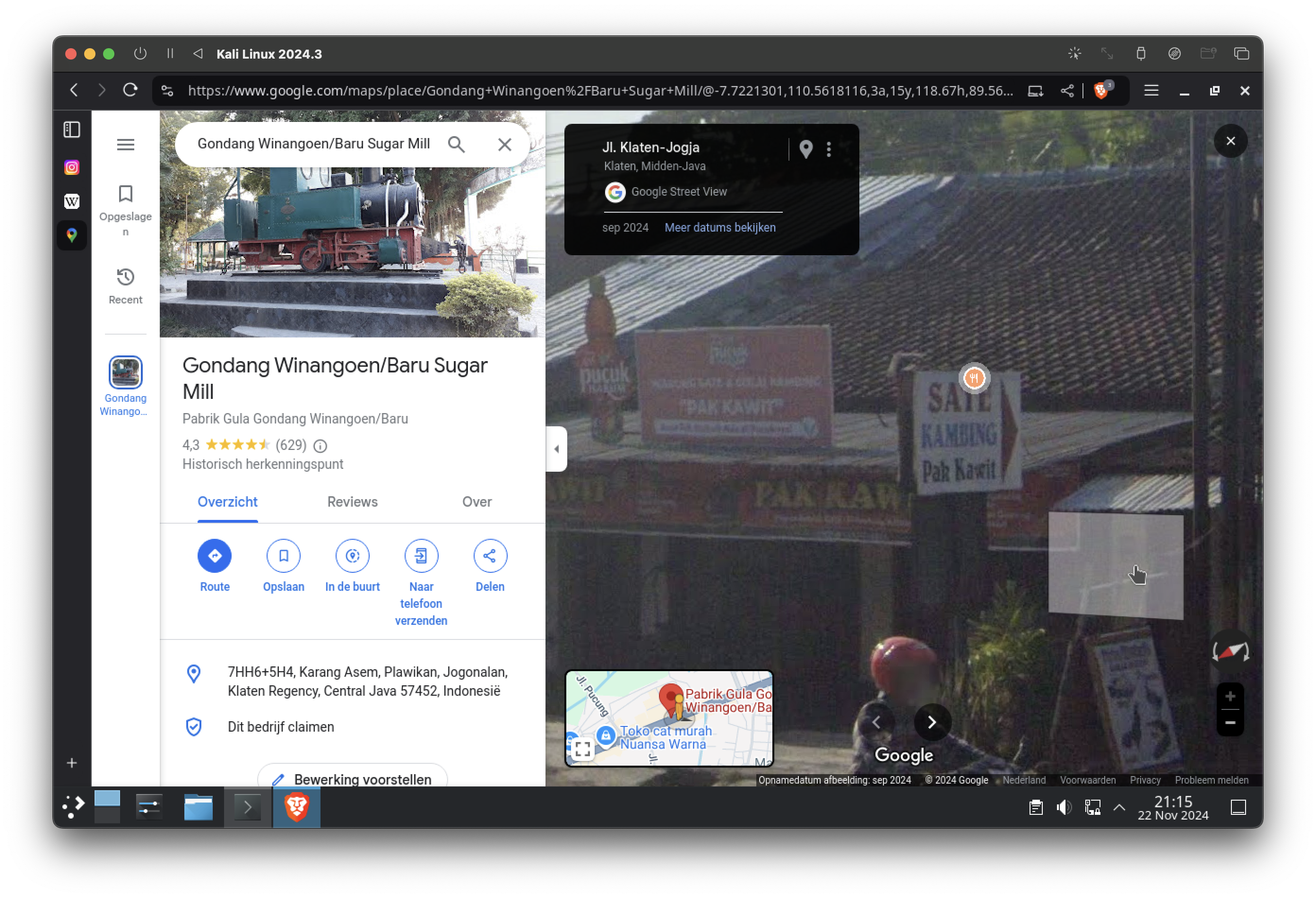
- The “Sate Kambing” Label
Both of these signs are visible in the background, across the road from where the photo was taken. Let’s take a closer look.
The "Notaris/PPAT" Label
The label Notaris/PPAT (Notary Public/Official Land Deed Officer) is visible to the left in the photo. On Google Maps, the same label appears on the building directly opposite PG Gondang Winangoen. This not only strengthens our geolocation but also indicates the specific spot from which the photo was taken.
The “Sate Kambing” Label
To the right of the "Notaris/PPAT" label, there’s a sign advertising Sate Kambing (grilled goat skewers), a popular Indonesian dish. The placement and design of this sign match perfectly with its Google Maps counterpart, further cementing the match between the real-world location and @ridwanhr’s photo.
Piecing It All Together
These additional observations—along with the previously analyzed train carriage, shade, and trees—provide an unshakable conclusion. Each clue independently points to the same location, and together they form an irrefutable chain of evidence.
From this analysis, we can confidently state that @ridwanhr took the photo at PG Gondang Winangoen in Klaten, Central Java.
Key Takeaway: Thorough OSINT investigations rely not just on identifying single matches but on building a robust web of corroborating evidence. By cross-referencing visual elements with geospatial data, we leave no room for doubt in our conclusions.
The Results
| Key | Value |
|---|---|
| Identify where the photo was taken. | PG Gondang Winangoen, Klaten, Central Java |
| What's the coordinate of the location? | -7.721892574503646, 110.56186863631719 (7°43'18.8"S 110°33'42.7"E) |
| Tell a story about the location. | Gondang Winangoen or Gondang Baru was a sugar refinery located in Klaten Regency, Central Java, Indonesia. Owned by PT Perkebunan Nusantara IX, it was operated from 1860 until 2017. It has the one and only sugar museum in Southeast Asia. The museum was founded in 1982 to coincide with the 1982 World Sugar Congress which was held in Jakarta. [Wikipedia] |
Additional Insights
Critical Thinking in Action
This investigation underscores the importance of combining observation, context, and verification:
- Observation: Noticing details like the train’s condition and shadows led us to question its surroundings.
- Contextual Knowledge: Understanding Indonesia’s railway and sugar refinery history narrowed the possibilities.
- Verification: Cross-referencing Google Maps confirmed the location with high accuracy.
Broader Lessons
OSINT isn’t just about solving puzzles—it’s about connecting dots and thinking critically. Whether geolocating an Instagram post or investigating cybersecurity incidents, the same principles apply: observe, analyze, verify, and contextualize.
Key Takeaway: Even a simple photo can reveal a wealth of information when approached methodically. OSINT teaches us that the truth often lies in the details we might otherwise overlook.
This note is written by Diky Hadna — Software Engineer & Digital Nomad Mentor. Read my story and get in touch with me!