🔎 OSINT Case Study: Oan Resort
Taken from Sofia Santos' OSINT Exercise #004
Hi there 👋 Welcome to the first installment of the OSINT Case Study series on this website! In this article, I’ll demonstrate how we can identify a location using just a single photo. This particular exercise falls under the GEOINT (Geospatial Intelligence) category, but it is equally relevant to OSINT due to its investigative nature. The case study is based on Sofia Santos' OSINT Exercise #004, and I encourage you to participate directly if you'd like to test your skills.
Task Briefing
| Key | Value |
|---|---|
| Brief | This is a photo of a resort located on an island. |
| Objectives | 1. What is the name of the resort? |
| 2. What are the coordinates of the island? | |
| 3. In which cardinal direction was the camera facing when the photo was taken? | |
| Original URL | https://gralhix.com/list-of-osint-exercises/osint-exercise-004/ |
| Difficulty Level | For Beginner: easy - medium |
| For Expert: easy | |
| Data Source | 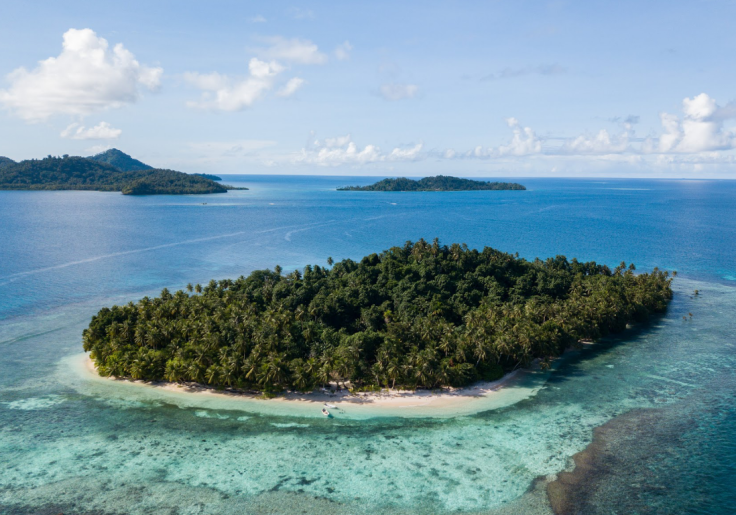 |
Steps to Analyze
1. Download the Original Image
The first step in any image-based investigation is to ensure we’re working with the best possible version of the photo. The original image can be downloaded from this link.
Here's what the image looks like:

By analyzing the photo, we can already make some initial observations:
- The photo shows a tropical environment with trees, clear waters, and resort-like architecture.
- There are no immediate, obvious landmarks visible, which makes it a perfect case for OSINT techniques.
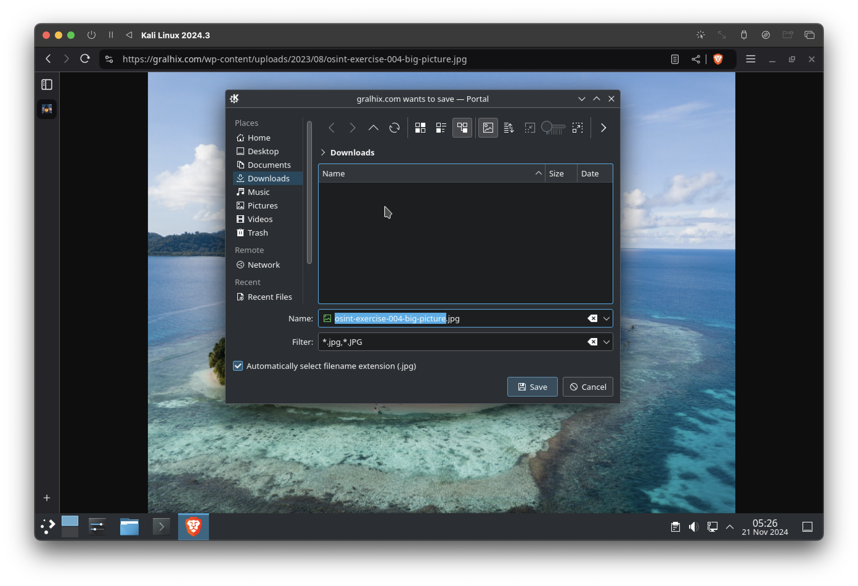
Now, let's download this photo:
2. Analyze the EXIF Data
EXIF data (Exchangeable Image File Format) often provides useful metadata such as the camera model, time taken, and GPS coordinates. We analyzed the EXIF data using the exiftool command in Kali Linux (you need to install and/or configure the tool first).
exiftool {path-to-image}
Unfortunately, this image did not contain meaningful EXIF data—specifically, no GPS information was available. While this is common when dealing with compressed or stripped images, it doesn't stop the investigation.
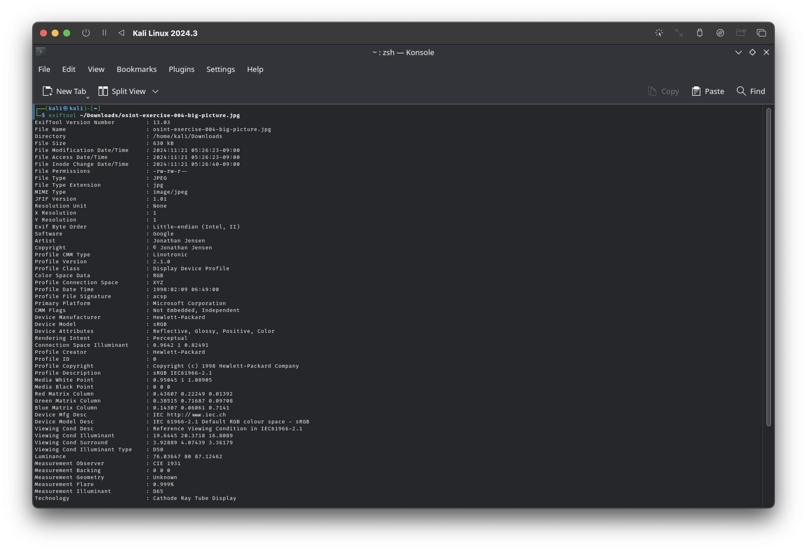
Critical Thinking: The absence of EXIF data might suggest the photo was shared via platforms that strip metadata for privacy, such as social media. This observation can provide context about the image's origin.
3. Use Google Image Search
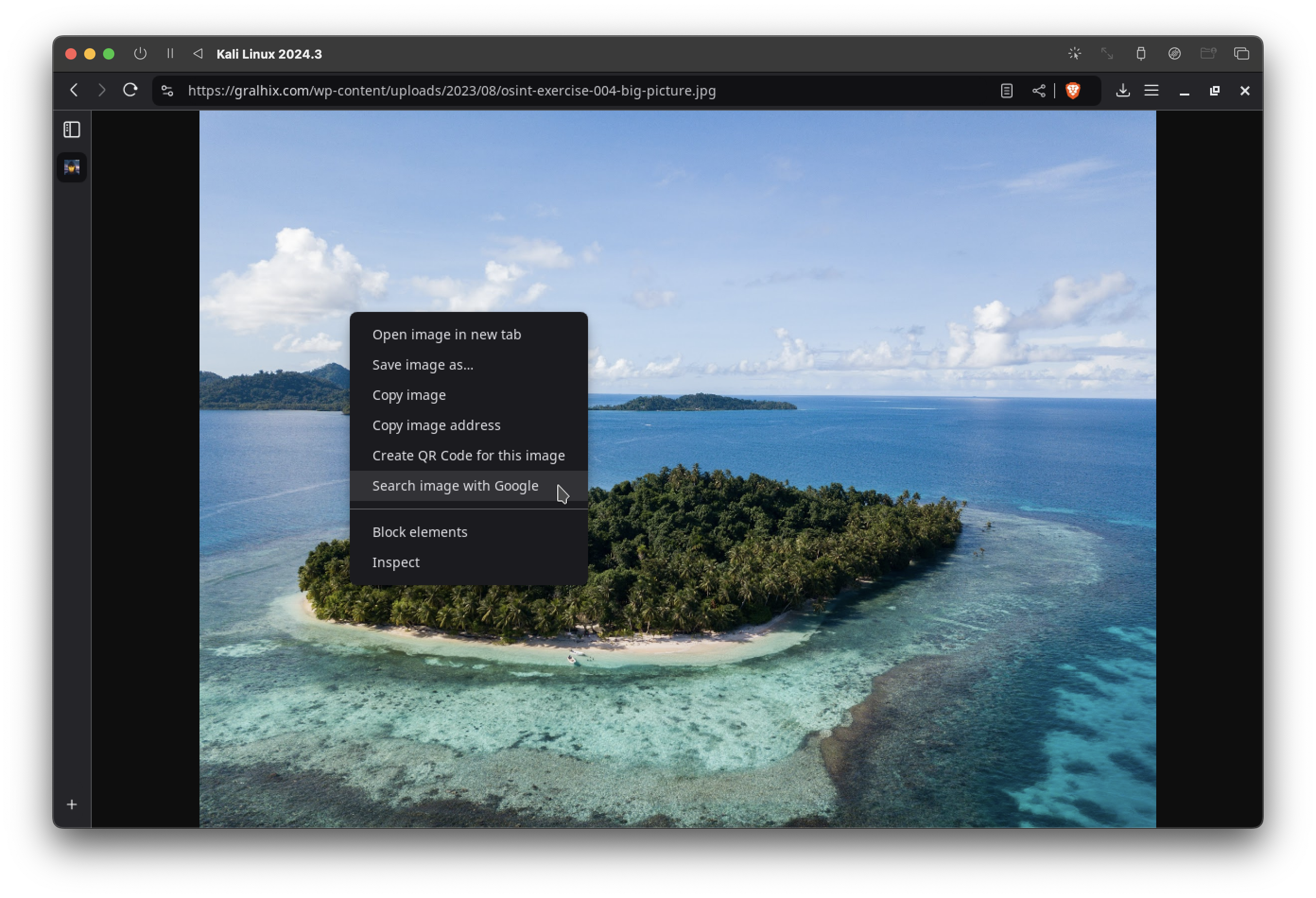
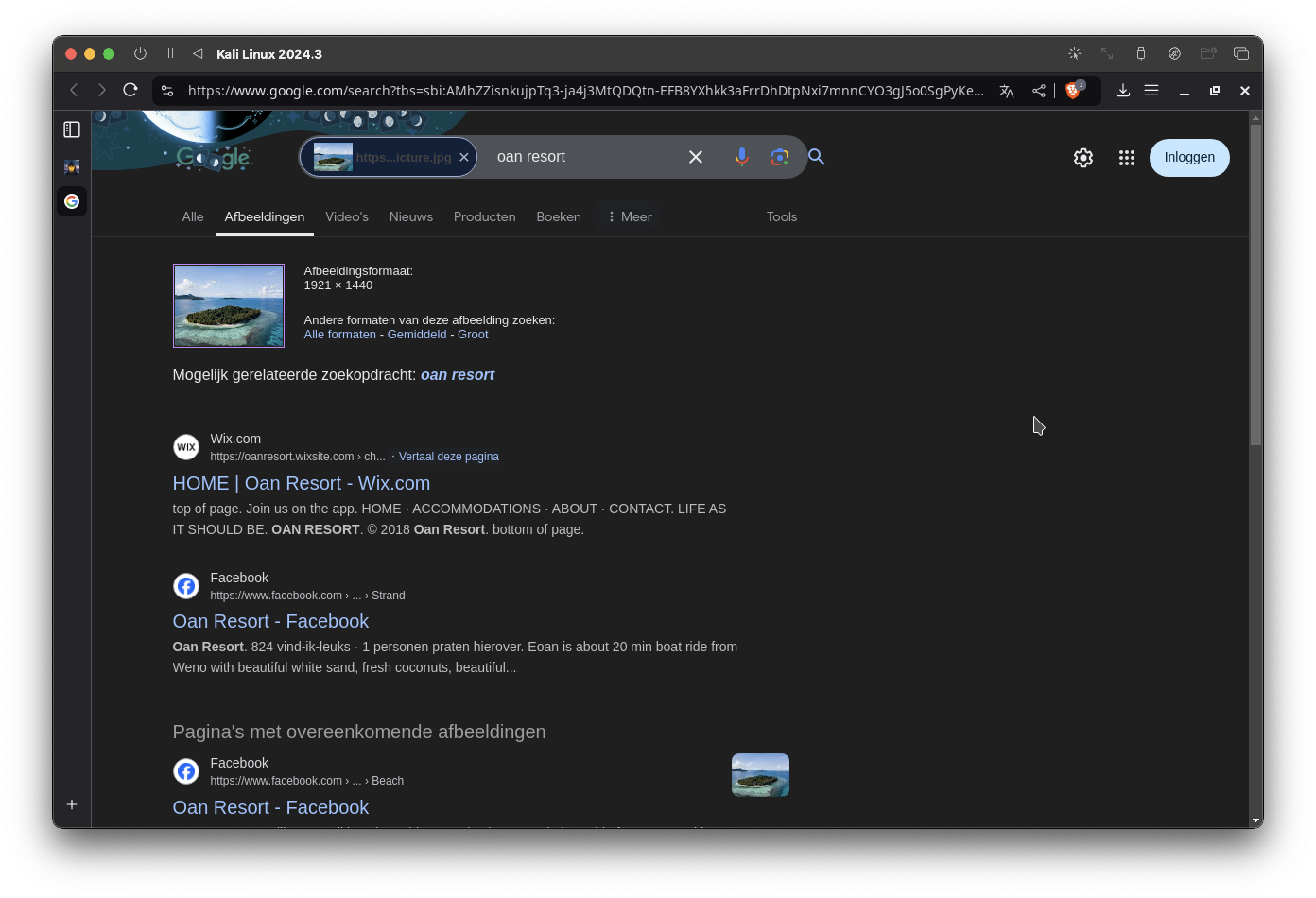
When EXIF data fails to yield results, reverse image search is an effective next step. Using Google Image Search, we uploaded the photo to find visually similar results. If you're using Chrome or a compatible browser, you can right-click the image and select the "Search image with Google" option.
4. Analyzing the Search Results
The reverse image search revealed multiple matches for the photo. Among them, a specific match stood out: the image was identified as being taken at Oan Resort, located in Micronesia.
This result significantly narrows our scope of investigation. We now have a location to verify and additional data to explore.
5. Keyword Confirmation
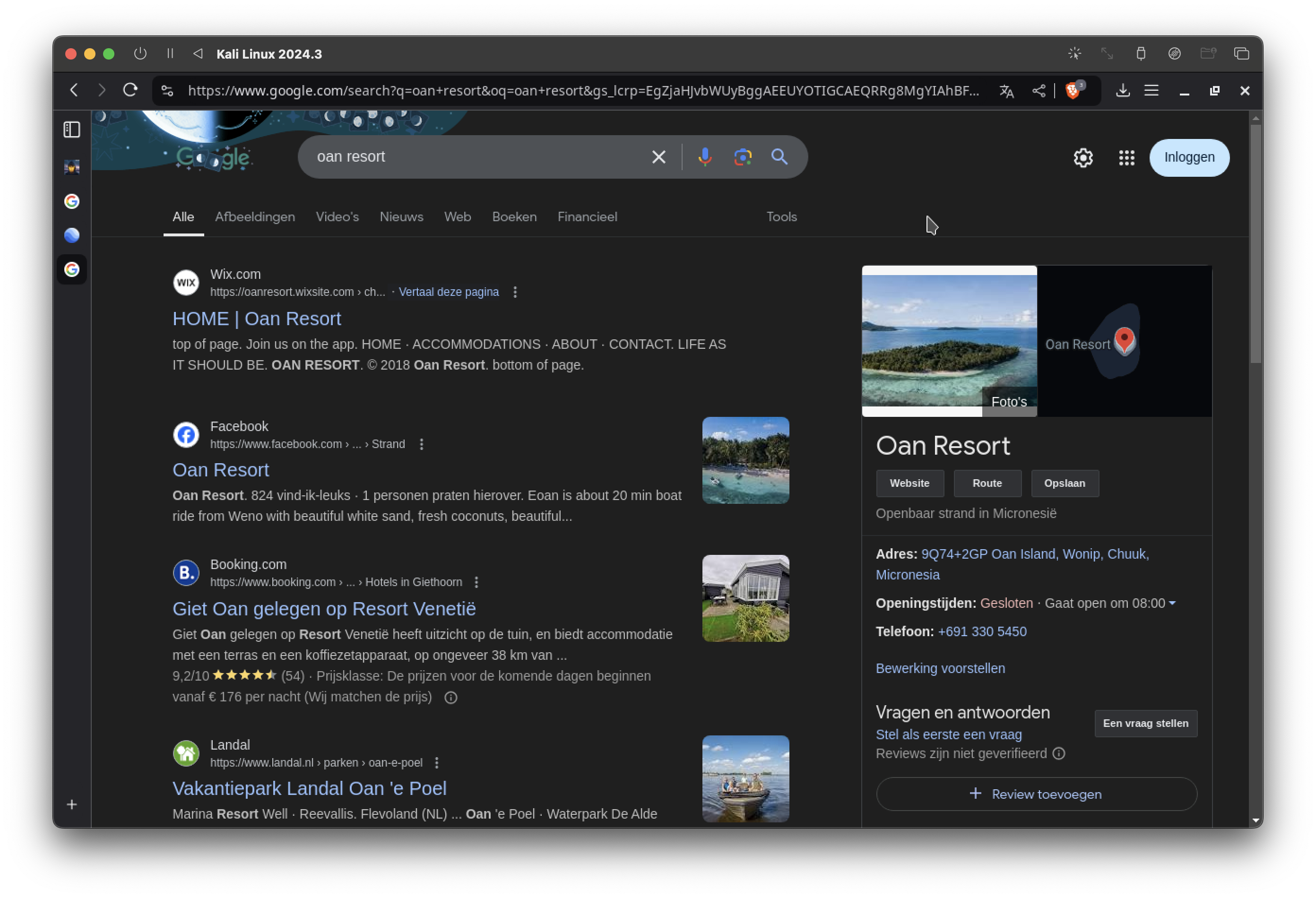
To confirm the accuracy of the reverse image search, we conducted a manual Google Search using the keywords "Oan Resort." The results corroborated the reverse search findings, with several images and descriptions matching the original photo.
6. Explore the Area with Google Earth
To pinpoint the coordinates of the island, we turned to Google Earth, a powerful tool for geospatial analysis. Google Earth allows us to explore the island in detail and cross-reference the surroundings visible in the original photo.
Upon locating Oan Resort, we noted its exact position and verified the orientation of key features in the image. The camera was facing Northwest, as determined by the placement of the coastline and visible landmarks relative to the compass.

Result Summary
| Key | Value |
|---|---|
| What is the name of the resort? | Oan Resort |
| What are the coordinates of the island? | 7.362770652280837, 151.75635098360198 (7°21'46.0"N 151°45'22.9"E) |
| In which cardinal direction was the camera facing when the photo was taken? | North West |
Additional Insights
Reflection on the Process
This case study demonstrates how multiple OSINT techniques can be used in sequence to piece together a complete picture. Each step builds on the findings of the previous one, emphasizing the importance of combining tools, methods, and critical thinking.
Ethical Implications
While this exercise was conducted for educational purposes, it underscores the vast amount of information publicly accessible online. This availability raises questions about privacy and data security. Practitioners must always operate within ethical and legal boundaries, ensuring their work serves legitimate purposes.
Critical Thinking in OSINT
During this exercise, several subtle details informed our approach:
- EXIF Analysis Context: The absence of metadata hinted at a deliberate action, such as sharing via privacy-conscious platforms.
- Visual Clues: The tropical environment, architecture, and water features aligned with characteristics of Micronesian islands (althought we do not know it yet at the beginning).
- Tool Selection: The choice to use Google Earth over Maps allowed for a more detailed spatial analysis, including terrain and orientation. These moments reflect how OSINT is not merely about tools but also about interpreting and connecting data meaningfully.
Closing Thoughts
This case study highlights how powerful OSINT can be, even for seemingly simple tasks. By methodically leveraging publicly available information, we uncovered the name, location, and orientation of a resort on an island based on just one photo.
For professionals, enthusiasts, or anyone curious about the potential of OSINT, exercises like this are invaluable for sharpening skills and understanding the broader implications of open data.
Let me know if you enjoyed this case study, or if you have suggestions for future topics. Happy investigating! 🚀
